GPS Photo Proof for Insurance Adjusters
Eight inspections in a day, four of them duplexes, and by six o'clock every photo is sitting in one camera roll with nothing on it but pixels. Later that week you are matching a shot of a stained ceiling to a claim number from memory — and the only thing telling you which unit it came from is the order the files happen to be in.
Where the file falls apart
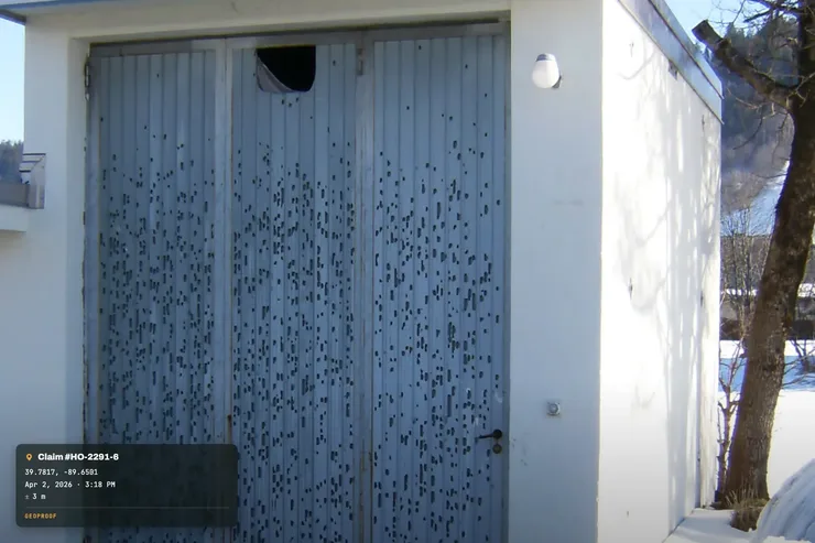
Photos migrating between claims. Two losses on the same street after the same hailstorm. Both roofs are the same age, the same colour, the same damage pattern. If a photo lands in the wrong file, the mistake is invisible — nothing in the image contradicts it. An address stamped on the face of the shot makes that error impossible to miss and impossible to make.
The claim that reopens fourteen months later. By the time it comes back, it is on somebody else's desk. That adjuster is reading your photos cold, with no memory of the inspection. What they need is not your notes — it is a picture that states its own address and its own date without needing you to confirm it.
The neighbouring property in frame. You photograph a fence line, a tree strike, a shared wall. Which side of the boundary was the shot taken from? Coordinates and a compass heading on the photo answer that. A bare JPEG does not.
What gets printed on each photo
Burned into the image at capture
- GPS coordinates and the accuracy achieved
- Street address for those coordinates
- Date and time, checked against a public time server — not just whatever the handset's clock says
- Compass heading, so a north elevation is labelled as one
- Altitude
- Weather at the moment of capture, optional and off by default
- Your firm's logo and the claim or job name
The time check is the field worth pausing on. A phone clock can be wrong, and it can be changed. GeoProof asks a public time server what the time actually is and stamps that. It is a better answer than the handset alone, and it is still only what the app can measure.
Each photo also gets a SHA-256 fingerprint at capture, so you can re-check later whether that exact file has changed since it was taken. That is the whole of it: a change check on a file. GeoProof is not a legal service and makes no claim about how any photo will be treated by anyone else — it reports what it can measure and stops there.
Working a property
- In the car, before you get out. Set the job name to the claim number. Everything you shoot for the next hour carries it.
- Establishing shot from the street. Whole risk in frame, with the address stamp on it. This is the photo that anchors every other photo in the file to a location.
- Elevation by elevation. Work around the building in one direction. The heading on each shot means the front elevation is identifiable as the front elevation a year from now, by someone who has never been there.
- Interior and cause of loss. Room shots, then the damage, then the source. Overview before close-up, so a close-up of a wet ceiling is attached to a room somebody can find again.
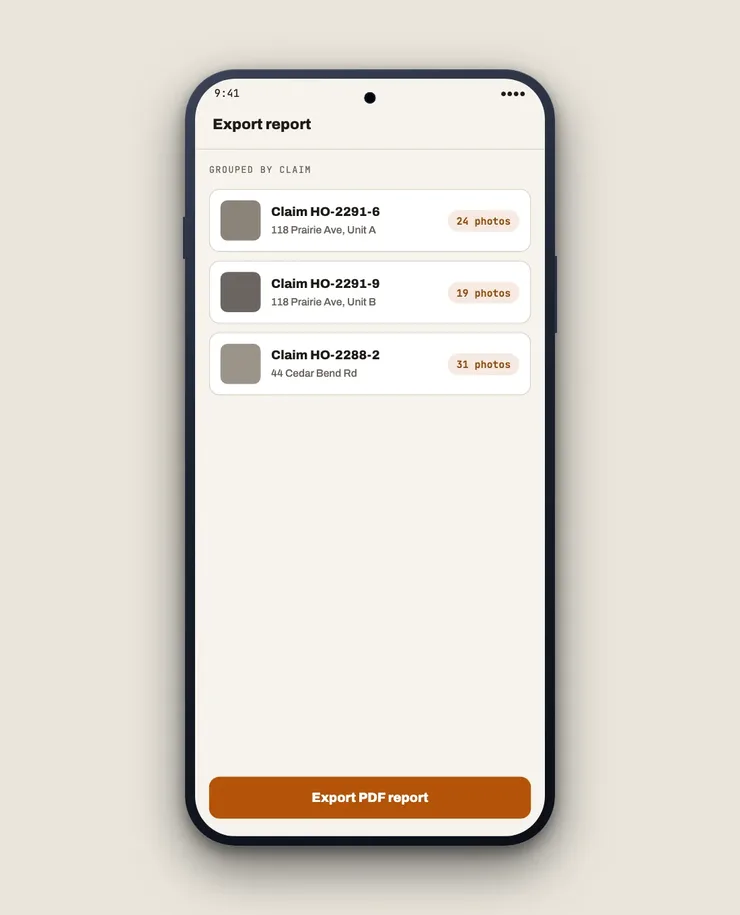
- Before the next appointment. Export a PDF grouped by claim number, notes attached, and drop it into the file while the property is still fresh in your head.
After a catastrophe, when nothing works
This is the situation that actually tests an app. Post-event, the towers are overloaded or down, and half the neighbourhood has no power. GPS is unaffected — the satellites do not care about the local network — so coordinates, time, heading and altitude all land on the photo as normal.
The street address is the one field that needs a connection, because looking up a street name means asking a server. On a dead network you get the coordinates immediately and the address is filled in afterwards, once the phone is back in coverage. Plan around that on CAT deployments: the position is never lost, the street name is just late.
Nothing is uploaded
No account, no cloud, no sync. Photos of insured properties and their contents stay on the device, because there is no GeoProof server for them to go to. That also means the only copy is the one you have — export the PDF into your own claim system the same day.
Pricing
Free to use. One-time Pro unlock. No subscription, no seat licences, no ads.
Related
- All trades
- Add location to photos on iPhone — what the built-in Photos app does, and where it stops
- For roofing contractors — the contractor's side of the same hail claim